Lake Maps
Interactive Map
With this map you are able to zoom in and out using the controls on the left. You can also switch between Map and Satellite view with the buttons in the upper right hand corner to switch between navigational and more realistic landscape imagery. By clicking inside it, you can drag the map around to your desired location.
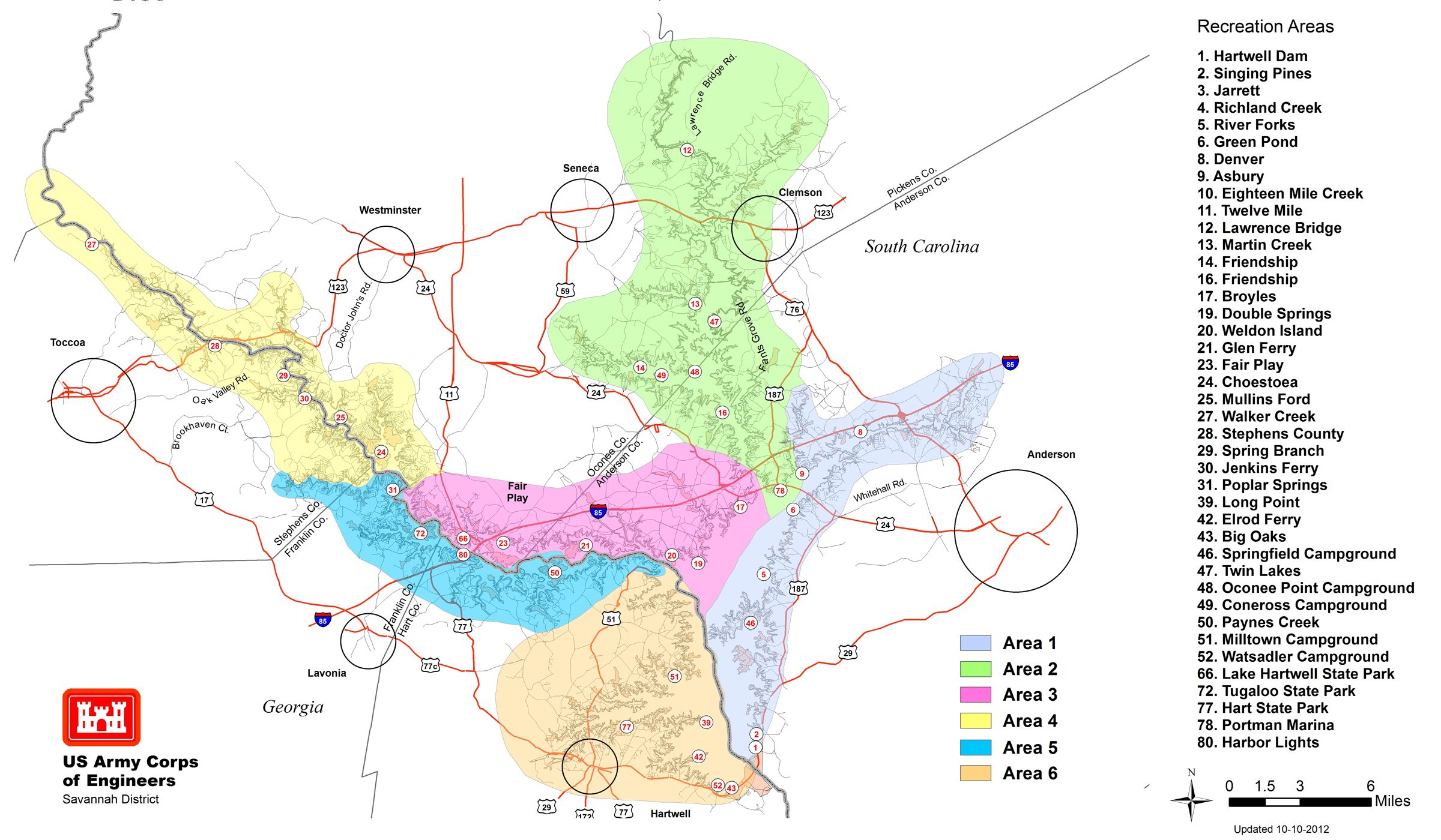
USACE Shoreline Areas Map
With this map, you can see the 6 primary shoreline areas as designated by the US Army Corps of Engineers (USACE). These include the shorelines near the larger communities around the lake such as Anderson (Area 1), Clemson/Seneca (Area 2), Fair Play (Area 3), Toccoa/Westminster (Area 4), Lavonia (Area 5) and Hartwell (Area 6). This map also shows a number of the larger recreational areas around the lake. Click directly on the map to see a larger version that you can zoom and tour.
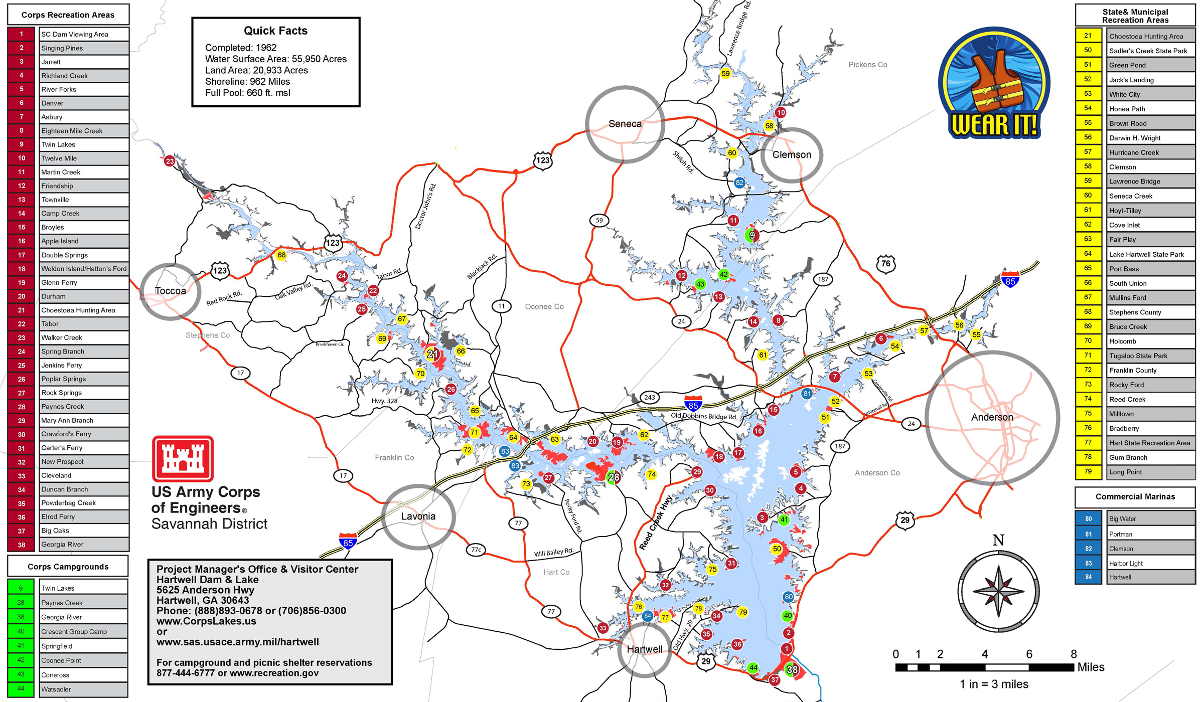
USACE Recreational Areas Map
With this map, you can see a complete listing of the 5 Commercial Marinas (blue), 31 State & Municipal Recreation Areas (yellow), 38 USACE Recreation Areas (red) and 8 USACE Campgrounds (green). As you can see, besides being out on the water, there is an incredible number of recreational options around the lake as well. Click directly on the map to see a larger version that you can zoom and tour.
Recreational Area Information
For specific facility or campground information on and around Lake Hartwell and surrounding lakes in Georgia and South Carolina, including hours of operation, seasonal passes, rules and regulations, please visit the following websites: